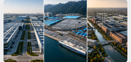
Snapshot
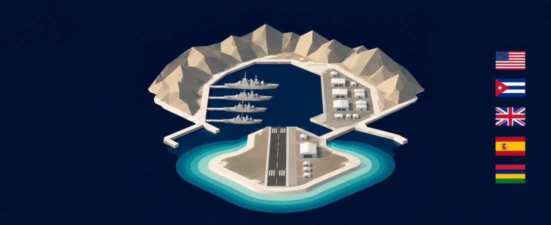
Guantánamo Bay, Diego Garcia and Rota all combine naval and air infrastructure, but they produce three different kinds of military place. Guantánamo is a politically isolated leasehold beside a state that rejects the continuing US presence. Diego Garcia is a geographically isolated base on a low atoll within a territory whose sovereignty and displaced population remain disputed. Rota is a Spanish base used jointly with the United States and connected to the towns, labour market and transport systems of Andalusia. Their operational value cannot be separated from these territorial relationships: sovereignty shapes access, access shapes settlement, and settlement shapes how each installation functions beyond its secured perimeter.
| Criterion | Guantánamo Bay | Diego Garcia | Rota |
|---|---|---|---|
| Territorial arrangement | Cuban sovereignty; United States exercises jurisdiction and control under the 1903 lease arrangements preserved by the 1934 treaty | Administered by the United Kingdom as BIOT; joint UK–US base. The 2025 UK–Mauritius treaty is signed but not in force | Spanish sovereign territory and Spanish naval base; US use governed by bilateral defence agreements |
| Form of separation | Political and legal separation from surrounding Cuba | Geographic remoteness and restricted entry | Secured perimeter with routine movement into the surrounding Spanish region |
| Development baseline | US naval station established in 1903; detention complex added from 2002 | US construction began in 1971; official Navy history describes the facility as fully operational by 1986 | 1953 basing agreement; runway opened in 1956 and port in 1958 |
| Published footprint | 45 sq mi / 116 km² of land and water | About 27 km² of land; the wider atoll includes a lagoon of about 124 km² | 6,100 acres / about 24.7 km² for the Spanish base |
| Public population baseline | Nearly 6,000 people in a 2017 Navy review; no comparable current total found | About 2,500 on the installation page; its category subtotals do not reconcile | About 7,000 Americans within 25 miles; about 8,000 when contractors and Spanish local-national employees are included |
| Settlement model | Family-accompanied, self-contained garrison | Dependent-free, contractor-heavy temporary population | Family-accompanied binational community integrated with nearby towns |
| Naval–air function | Access and sustainment for an enclave divided by a bay | Long-range logistics platform in the central Indian Ocean | Allied gateway supporting movement, maintenance and forward-deployed forces |
| Environmental constraint | Hurricane exposure and locally maintained utilities | Very low terrain, coastal exposure and long recovery routes | Heat, drought and coastal exposure moderated by regional connectivity |
The published areas have different boundaries: Guantánamo’s includes land and water, Diego Garcia’s covers land, and Rota’s covers the Spanish base. Population estimates likewise count different groups and years. They describe spatial and social arrangements but do not establish a reliable size or population ranking.
Basis of comparison
The comparison examines how territorial status and physical geography influence six connected dimensions: spatial form, naval and air functions, settlement, movement, relations with surrounding populations, and environmental recovery. It uses official installation material, treaties, parliamentary records and scientific studies. Operational capacity that is absent from the public record is not inferred from infrastructure alone.
The relevant unit is the whole functioning place, not only the secured technical core. That includes the bay and divided settlement at Guantánamo, the atoll and lagoon at Diego Garcia, and Rota’s relationship with nearby Spanish towns. This wider view reveals differences that an inventory of runways, piers and buildings would miss.
Location and physical setting
The three installations depend on maritime and air access, yet their locations create different forms of separation. Guantánamo is close to Cuban territory and settlements but has no normal land connection through them. Diego Garcia is separated by ocean from any substantial civilian centre. Rota sits inside a dense mainland network of towns, highways, commercial airports and ports. Physical distance is therefore only one component of isolation: Guantánamo is nearby but politically cut off, Diego Garcia is remote in both distance and access, and Rota is secured without being territorially detached.
Guantánamo occupies the southeastern Cuban coast around an enclosed bay. The water divides the station into Windward and Leeward sectors, turning internal movement into a spatial problem as well as an access function. Diego Garcia’s horseshoe-shaped coral landform is narrower and more environmentally constrained: about 27 km² of land surrounds a lagoon of approximately 124 km², and most terrain rises only a few metres above sea level.[6][12][13] Rota’s 6,100 acres sit on the Bay of Cádiz near the Atlantic approaches to the Strait of Gibraltar. Its harbour and airfield form part of the same regional geography as Cádiz, Jerez and Seville; the meteorological station at the base stands at 21 metres.[14][17]
These settings give each installation a different dependence on its surroundings. Guantánamo must reproduce services that neighbouring Cuba cannot routinely provide to it. Diego Garcia must import personnel and supplies across very long distances. Rota can combine military transport with the civilian systems of southern Spain. Geographic position consequently shapes both operational connectivity and the amount of everyday infrastructure kept inside the perimeter.
Origins and spatial development
Each base began through a different political arrangement, and those origins still govern its physical development. Guantánamo grew from a lease that separated jurisdiction and control from Cuban sovereignty. Diego Garcia developed through the colonial detachment of the Chagos Archipelago and the removal of its population. Rota emerged from a bilateral defence agreement and later evolved within a closer alliance. These are not merely historical distinctions: they explain why one base operates as an enclave, another without a civilian settlement, and the third alongside an active host society.
At Guantánamo, the United States and Cuba established the coaling and naval station through the 1903 agreements. The 1934 Treaty of Relations preserved the arrangement unless the United States abandons the station or both governments agree to alter it. After relations deteriorated following the Cuban Revolution, Cuba cut the base’s water supply in 1964; local water and power systems became part of the installation’s political separation. The detention facilities opened in 2002 and imposed a prominent, separately controlled function on the older naval landscape.[2][3]
Diego Garcia followed a different sequence. The United Kingdom detached the Chagos Archipelago from Mauritius in 1965, created the British Indian Ocean Territory and made it available for defence purposes under a 1966 UK–US agreement. Chagossians were removed between 1968 and 1973, while US construction began in 1971. The installation expanded from communications support into an air, port and logistics complex, reaching the official Navy history’s operational baseline by 1986.[7][9][11] The absence of a civilian town is therefore a political outcome as well as a feature of remoteness.
Rota’s development produced greater institutional and spatial integration. The 1953 Pact of Madrid initiated construction; the runway opened in 1956 and the port in 1958. The 1988 Agreement on Defense Cooperation and later amendments placed US use within a bilateral structure that affirms Spanish sovereignty and command. Forward-deployed US destroyers began arriving in 2014, and five are currently homeported at Rota while expansion toward six continues.[14][15] Unlike the other two sites, operational growth has occurred without separating the base community from the surrounding host region.
Scale, spatial form and land use
The installations cannot be ranked by their headline areas because the figures measure different things. Guantánamo’s 45 square miles include land and water; Diego Garcia’s approximately 27 km² describes the atoll’s land; Rota’s 6,100 acres describe the Spanish base. Their spatial forms provide a more useful comparison: Guantánamo is divided, Diego Garcia is linear and coast-constrained, and Rota is a consolidated mainland campus.
At Guantánamo, the bay separates the Leeward airfield from the larger concentration of housing, administration, healthcare, education and retail on Windward. Port, utility, security and detention zones further divide the leasehold.[1][5] Its large published footprint therefore does not mean that it has the largest developed area. Water is both an operational asset and an internal barrier.
Diego Garcia concentrates a runway, port, fuel and logistics systems, utilities and accommodation along a narrow coral rim. The lagoon supports maritime access, but the atoll form places major systems close to the coast and limits opportunities to move infrastructure inland.[6][12][13] Rota has a less constrained geometry: a 670-acre airfield, three active piers, weapons and fuel facilities, housing, administration and Spanish and US operational areas occupy one secured perimeter.[14] Its mainland form permits a denser multi-use campus and direct land connections beyond the gates.
Spatial efficiency therefore has a different meaning in each case. Guantánamo must bridge two sides of a bay; Diego Garcia must fit critical systems onto limited low land; Rota must coordinate shared functions and jurisdictions within a connected base. The decisive difference is the relationship between infrastructure and territory, not the nominal area.
Maritime and air interface
All three sites join naval and air systems, but those systems solve different strategic and geographic problems. At Guantánamo they sustain an enclave. At Diego Garcia they create long-range reach from an otherwise isolated atoll. At Rota they connect forward-deployed forces to an allied regional network.
Guantánamo’s port supports visiting vessels and supplies, while ferries link Windward and Leeward. The Leeward airfield provides the principal passenger gateway because normal overland travel through Cuba is unavailable.[4] Maritime and air infrastructure are consequently essential to the continued functioning of the settlement itself, not only to external missions.
Diego Garcia’s lagoon, port and long runway operate as one logistics platform for US and allied forces in the Indian Ocean and Arabian Gulf.[6][7] Its location gives it strategic reach while imposing heavy dependence on organised transport, stored supplies and long support chains. Rota performs a more networked role. Its piers, airfield, cargo, fuel, weapons and maintenance functions support US and NATO movements between the Atlantic, Mediterranean, Europe, Africa and the Middle East. Five Arleigh Burke-class destroyers are currently based there and contribute to NATO integrated air and missile defence.[14][15]
The comparison changes the meaning of “connectivity.” Guantánamo’s connections compensate for political closure; Diego Garcia’s overcome distance; Rota’s multiply the advantages of proximity, allied infrastructure and onward routes. Similar physical assets therefore create different kinds of strategic place.
Settlement and everyday environment
The three settlement models correspond directly to their territorial relationships. Guantánamo reproduces a small American garrison town inside the leasehold. Diego Garcia maintains a temporary workforce without accompanying families or a civilian host settlement. Rota distributes daily life across the base and surrounding Spanish communities. Family presence and off-base movement are therefore analytical differences, not secondary amenities.
A 2017 Navy health review counted nearly 6,000 service members, government civilians, contractors and dependants at Guantánamo.[5] Housing, schools, healthcare, retail and recreation are provided inside the installation because personnel cannot use neighbouring Cuban communities in an ordinary way. The resulting self-sufficiency supports continuity but reinforces social and spatial separation.
Diego Garcia’s official installation page estimates about 2,500 people, although its category subtotals do not reconcile.[6] The population is dependent-free and contractor-heavy, with limited specialist healthcare, shopping and civic life. Chagossian heritage remains part of the place even though the resident community was forcibly removed. The installation’s everyday environment is thus defined by rotation and employment, while the absence of a permanent civilian society records the archipelago’s displacement history.[8][9]
Rota combines military housing and services with routine residence, employment and consumption beyond the base. Official material counts about 7,000 Americans within 25 miles—more than 3,500 active-duty personnel, nearly 3,000 family members and more than 500 US civilians—and a broader community of about 8,000 when contractors and Spanish local-national employees are included.[14][15] These figures are not directly comparable with Guantánamo’s installation count or Diego Garcia’s estimate. They demonstrate a different social form: the Rota community extends outside the fence and includes host-country labour and services.
Access, connectivity and isolation
Access reveals three distinct security geographies. Guantánamo combines strong perimeter control with a political barrier at the edge of the leasehold. Diego Garcia restricts entry across an oceanic approach. Rota controls its gates while permitting routine interaction with the surrounding region. None is publicly open, but their restrictions operate at different scales.
At Guantánamo, authorised personnel and visitors depend primarily on organised air and sea transport, and supplies arrive through the same systems. Internal ferries are part of ordinary circulation because the bay divides the station.[4] At Diego Garcia, country clearance and mission need govern admission; leave travel is not authorised and family members cannot visit. Distance also raises the cost and time required for medical evacuation, specialist repair and resupply.[8]
Rota’s Spanish-controlled gates mark a secured institutional boundary, not a break with the host territory. Roads lead directly to Rota, El Puerto de Santa María, Jerez, Cádiz and Seville; civilian airports supplement the base’s military terminal.[14] Personnel can work inside the perimeter and participate in ordinary regional life outside it. Rota is therefore the most territorially permeable of the three, while remaining subject to military access control.
Isolation also changes operational resilience. Guantánamo can sustain itself locally but has few alternative civilian connections. Diego Garcia’s extreme distance creates the greatest logistical dependence on prearranged routes. Rota has more external pathways and services, although reliance on a populated host region introduces coordination requirements absent from a closed installation.
Relationship with the host territory and population
The bases represent three different relationships between sovereignty, command and surrounding society. At Guantánamo, sovereignty and day-to-day control are divided between hostile states. At Diego Garcia, UK administration, Mauritian sovereignty claims, the UK–US defence relationship and Chagossian displacement overlap. At Rota, Spanish sovereignty and command coexist with extensive US use inside an established alliance.
Cuba retains sovereignty over Guantánamo Bay while the United States exercises jurisdiction and control under the lease. The United States does not own the territory, and Cuba rejects its continuing presence. Cuba has no ordinary role in the station’s governance or daily services.[1][3] The boundary therefore expresses political conflict as well as military security.
Diego Garcia’s position is unsettled in a different way. As of 21 August 2026, the United Kingdom continues to administer BIOT and the current UK–US Exchange of Notes remains operative. The UK and Mauritius signed a treaty in May 2025 that would transfer sovereignty to Mauritius and authorise continued UK operation of the base for an initial 99 years, but the treaty has not entered into force. The implementing bill made no further progress after Parliament was prorogued in April 2026.[9][10] The International Court of Justice concluded in its 2019 advisory opinion that Mauritius’s decolonisation had not been lawfully completed and that UK administration should end as rapidly as possible.[11] Chagossians remain central to the place’s political meaning despite being excluded from its current settlement.
Rota’s division of responsibilities is more cooperative. Spain retains sovereignty, the Spanish Navy commands the base and Spanish forces operate its gates. Internal security is shared, while the US commander manages US activities under the Agreement on Defense Cooperation.[14][16] Local-national employment, off-base residence and routine use of nearby towns connect the installation to its host society. Integration does not remove military restrictions; it embeds them within a negotiated bilateral order.
These arrangements shape local legitimacy and visibility. Guantánamo is maintained despite rejection by the surrounding state. Diego Garcia’s value is inseparable from unresolved decolonisation and displacement. Rota’s role depends on continuing Spanish consent and institutional cooperation. “Foreign base” consequently describes three materially different territorial conditions.
Environment, hazards and resilience
Environmental risk depends on both exposure and the ability to recover. Guantánamo faces major storms but maintains substantial local utilities. Diego Garcia experiences lower cyclone frequency yet has exceptionally low terrain and long repair routes. Rota faces heat, drought and coastal hazards while retaining access to mainland infrastructure. A single ranking would conceal these different combinations.
Guantánamo is exposed to Caribbean heat, heavy rain and hurricanes. Official port guidance states that the harbour is not a hurricane safe haven and requires vessels to depart before adverse weather. The station’s locally maintained water and power systems reduce dependence on Cuba but concentrate responsibility for failures inside the enclave.[3][4]
Diego Garcia’s equatorial position reduces the frequency of tropical cyclones, but most developed land lies close to sea level and the coast. UK scientific material reports sea-level rise in BIOT at about twice the global average and identifies erosion and weakening reef protection as concerns.[12] Limited inland space and long supply lines could complicate recovery even when the initiating hazard is less frequent.
Rota’s Atlantic–Mediterranean setting brings hot, dry summers, wetter winters and regional exposure to drought, erosion and coastal flooding.[17][18] Its mainland connections provide access to a wider labour pool, transport network and public infrastructure. Those advantages do not establish the resilience of particular base systems, but they distinguish Rota’s recovery geography from the self-contained arrangements at Guantánamo and the long-distance dependence of Diego Garcia.
Distinctive identity
The identities of the three bases arise from the interaction of mission and territorial relationship. Guantánamo’s bay, self-contained settlement and disputed lease create an enduring enclave whose public identity is dominated by the detention mission. Diego Garcia’s runway and lagoon form a powerful logistics platform, while its empty civilian landscape embodies Chagossian displacement and contested decolonisation. Rota’s port and airfield operate as an allied gateway whose workforce, families and services extend into Andalusia.
These identities cannot be reduced to remoteness or strategic importance. Guantánamo is physically close to Cuba yet socially separated from it. Diego Garcia converts extreme geographic separation into operational reach. Rota gains strategic value through connection and negotiated access. The installations demonstrate that military control can be produced through exclusion, distance or integration.
Comparative conclusion
Guantánamo Bay, Diego Garcia and Rota share naval–air infrastructure but function through different territorial systems. Guantánamo sustains a politically isolated community inside a contested leasehold. Diego Garcia supports long-range operations through a temporary workforce on a disputed and environmentally constrained atoll. Rota supports forward-deployed forces through a sovereign Spanish base integrated with an allied mainland region.
Their differences follow a connected sequence. Territorial arrangements determine who controls the boundary; boundary conditions determine how people and supplies move; movement patterns determine settlement and service provision; those systems influence recovery from disruption. The physical base and its political geography are therefore one analytical object.
Rota’s permeability does not make it less military, and Diego Garcia’s remoteness does not by itself make it more capable. Guantánamo’s self-sufficiency does not remove its dependence on external air and sea routes. Each model provides strategic advantages while imposing a different set of political, social, logistical and environmental constraints.
Sources
1. U.S. Navy, “Naval Station Guantanamo Bay” — current official summary of location, area and jurisdiction. Links: Official page.
2. U.S. Navy, “Naval Station Guantanamo Bay: History” — lease and historical development. Links: Official history.
3. Congressional Research Service, “Naval Station Guantanamo Bay: History and Legal Issues Regarding Its Lease Agreements” — legal status, termination provisions and 1964 water cutoff. Links: CRS report.
4. U.S. Navy, “NS Guantanamo Bay Port Operations” — waterborne transport and hurricane-safe-haven warning. Links: Port Operations.
5. U.S. Navy, 2017 Camp Justice Public Health Review — dated population and settlement-layout baseline. Links: Public Health Review.
6. U.S. Navy, “About Diego Garcia” — mission and approximate population; detailed displayed subtotals are internally inconsistent. Links: About Diego Garcia.
7. U.S. Navy, “NSF Diego Garcia: History” — 1966 agreement, 1971 construction and 1986 operational milestone. Links: Official history.
8. U.S. Navy, “Diego Garcia Visitor Information” — access, clearance and family restrictions. Links: Visitor information.
9. UK Parliament, written answer on the UK–US Exchange of Notes, 27 July 2026 — current treaty and operating status. Links: Parliamentary answer.
10. House of Commons Library, “2025 treaty on the British Indian Ocean Territory/Chagos Archipelago” — treaty terms, displacement dates and ratification process. Links: Commons Library briefing.
11. International Court of Justice, Chagos Archipelago advisory opinion — 2019 conclusions on decolonisation and UK administration. Links: ICJ case page.
12. UK Joint Nature Conservation Committee, “Climate change impacts on corals: BIOT and the Pitcairn Islands” — sea-level, erosion and reef-risk evidence. Links: JNCC report.
13. U.S. Geological Survey, “Hydrogeology of Diego Garcia” — atoll, land and lagoon areas. Links: Hydrogeology study.
14. U.S. Navy, “Naval Station Rota: About” — current area, population, command, access and homeported-ship baseline. Links: Official About page.
15. U.S. Navy, “Naval Station Rota: History” — construction chronology, population history and current development. Links: Official history.
16. Government of Spain, 1988 Agreement on Defense Cooperation — bilateral legal and operational framework. Links: Official treaty text.
17. AEMET, “Climatological normals: Rota Naval Base” — official base weather-station setting. Links: AEMET station data.
18. European Environment Agency, “Extreme sea levels and coastal flooding in Europe” — regional coastal-risk context. Links: EEA indicator.