Snapshot
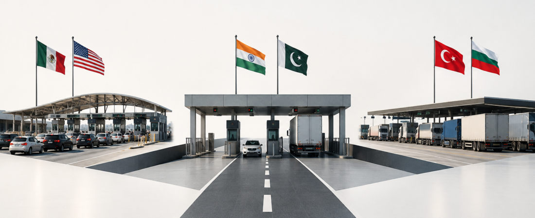
These three border complexes perform the same legal task—moving people or goods between sovereign states—yet traffic mix and political regime give each a different spatial form, operating logic and public meaning.
| Measure | San Ysidro–El Chaparral | Attari–Wagah | Kapıkule–Kapitan Andreevo |
|---|---|---|---|
| Border | United States–Mexico | India–Pakistan | Türkiye–Bulgaria |
| Dominant role | Passenger vehicles and pedestrians in a continuous urban region | Restricted passenger and cargo gateway; major ceremonial site | Road freight plus high-volume car, coach and seasonal diaspora traffic |
| Verified traffic reference | 15.85m personal vehicles and 6.85m pedestrians entered the US in 2023; outbound counts are not included [1] | 115,561 passenger movements and 7,348 cargo movements in 2024–25; both collapsed after the April 2025 closure [5][7] | 2.87m vehicles and 8.10m passenger movements in both directions in 2023 [9] |
| Freight | No regular truck processing; nearby Otay Mesa is the commercial port [3] | Infrastructure exists, but ordinary bilateral trade is suspended | Core function; Bulgarian Customs processed 1.04m trucks in both directions in 2023 [10] |
| Current regime | Stable, high-volume port with US and Mexican controls | Closed to ordinary crossing as of 21 August 2026; selected pilgrim movements have occurred by special clearance [7][8] | Active 24-hour EU external-border crossing |
| Spatial character | Dense metropolitan interchange with freeway and pedestrian terminals | Large, low-density land port beside a ceremonial arena and agricultural land | Extensive highway, customs, inspection and lorry-parking complex |
| Distinctive identity | Everyday binational mobility | Choreographed nationalism and diplomatic sensitivity | Continental logistics and seasonal queues |
The numbers are not directly interchangeable. US data count entries into the United States only; Indian land-port data report fiscal-year passenger and cargo movements; Turkish and Bulgarian series generally count movements in both directions. The comparison therefore uses each dataset to establish function and order of magnitude, not a single league table.
Location and physical setting
Physical setting explains how each crossing meets its hinterland. San Ysidro–El Chaparral occupies the land border between San Diego and Tijuana. Interstate 5 ends at the US inspection plaza and continues into Tijuana through the Mexican road network. Housing, retail, transit and road infrastructure press against both sides, so the port operates as part of a metropolitan centre rather than as an isolated frontier.
Attari–Wagah lies in the cultivated Punjab plain, about 28 kilometres from Amritsar and on the historic road toward Lahore. Its open setting permits a horizontally spread land port, security setbacks and grandstands at the border gate. Kapıkule–Kapitan Andreevo is also low and open, but its defining geography is the E80 road corridor between İstanbul, Edirne, Sofia and the rest of Europe. The paired facilities sit near Svilengrad and the Greek tripoint, with rail infrastructure and large vehicle-holding areas alongside the road.
Origins and spatial development
All three sites expanded by adding specialised processing space, although the cause differed. San Ysidro grew with twentieth-century metropolitan integration. A US modernisation programme completed between 2011 and 2019 created 34 northbound vehicle lanes with 62 primary booths, new secondary-inspection space, PedWest and PedEast pedestrian facilities, and a ten-lane southbound Interstate 5 connection to El Chaparral. The planned US project area was about 50 acres. [2]
Attari began as a post-Partition checkpoint and was recast as India’s first Integrated Check Post in 2012. The 118-acre, ₹150-crore project combined immigration, customs, health, quarantine, warehousing and cargo-transfer functions that had previously been dispersed. Its oversized yards and terminals were designed for organised passenger groups and bilateral freight, even though later policy decisions left much of that capacity underused. [6]
Kapıkule developed in response to sustained international road traffic. Türkiye modernised the gate under a build–operate–transfer programme and opened the renewed facility in 2009; later work enlarged truck-processing and parking capacity. [11] Kapitan Andreevo performs the matching Bulgarian and EU controls. In contrast with Attari’s policy-driven underuse, Kapıkule’s recurring problem is demand pressing against processing capacity.
Scale, spatial form and land use
Traffic mix produces three different plans. San Ysidro is lane-dense: passenger vehicles pass through repeated primary booths and secondary areas while pedestrians are separated into east and west terminals linked to transit and pick-up zones. The footprint is large, yet urban land constraints favour closely packed canopies, multilevel buildings and direct freeway connections.
Attari uses more land for fewer movements. Passenger and cargo terminals, warehouses, a cold store, weighbridges, parking, quarantine facilities and separate transfer areas are distributed across a broad secured compound. The ceremony grounds are adjacent but functionally distinct. Kapıkule–Kapitan Andreevo is the most logistics-oriented form: long channelised approaches, passport and customs booths, truck scanners, veterinary and food-control facilities, lorry parks and service areas extend along the highway. It is a pair of national compounds, not one jointly administered terminal.
Border-control infrastructure and functions
The three crossings share immigration, customs, inspection and surveillance, but they allocate those functions differently. San Ysidro concentrates on people and personal vehicles. CBP uses primary and secondary vehicle inspection, pedestrian halls and the SENTRI trusted-traveller programme; Mexico controls southbound entry through El Chaparral. Regular commercial trucks use Otay Mesa. [2,3]
Attari’s integrated model places passenger processing, cargo clearance, health, quarantine and security in one Indian complex. Its terminal was designed with separate arrival and departure wings, immigration and customs counters, baggage scanners and accommodation for large pilgrimage groups. Cargo is transferred through controlled zones because vehicles from one country have historically faced limits on movement into the other. [6]
Kapıkule and Kapitan Andreevo must process both transport and regulatory risk at high volume. Passport checks, customs declarations, vehicle and cargo inspection, agricultural controls and transit documentation operate in parallel. Bulgaria’s side is a listed Schengen border crossing point and an EU border-control post for specified animal products and goods. [12,13] Civilian customs and border-police agencies operate the terminals, while patrols and fencing secure the wider frontier.
Passenger, vehicle and freight flows
San Ysidro has the largest verified passenger-vehicle volume in the comparison. In 2023, 15,845,661 personal vehicles and 6,847,737 pedestrians entered the United States there. BTS does not publish a matching outbound series, so those figures cannot support a two-way daily total. The port’s passenger focus is equally important: California’s busiest commercial land port is Otay Mesa, where 1,034,188 trucks entered the United States in 2023. [1,3]
Attari shows how policy can override built capacity. LPAI recorded trade worth ₹4,370.78 crore and 49,102 cargo movements in 2018–19. By 2024–25 the site still recorded ₹4,148.53 crore of trade, but only 7,348 cargo movements; imports from Afghanistan account for part of this activity. After India closed the Integrated Check Post in April 2025, the 2025–26 totals fell to ₹117.02 crore, 214 cargo movements and 29,943 passenger movements. [5,7] The fiscal-year series includes activity before closure and subsequent controlled movements.
Kapıkule carries both freight and people at scale. Türkiye’s official 2023 series reports 2,868,535 vehicle movements and 8,104,408 passenger movements at Kapıkule in both directions. [9] Bulgarian Customs separately recorded 1,037,632 trucks processed at Kapitan Andreevo that year. [10] The passenger peak is strongly seasonal, reflecting summer journeys by car and coach among residents of Turkish origin in European countries.
Access, connectivity and crossing experience
San Ysidro provides the widest choice of access modes. Drivers reach the port on Interstate 5; the San Diego Trolley’s Blue Line terminates at San Ysidro Transit Center, from which pedestrians walk through a border terminal. PedWest connects to the Virginia Avenue Transit Center, while PedEast adjoins the main trolley and bus area. [2,4] Queues remain a structural problem, and SANDAG links delay to lost economic activity and additional emissions. [4]
Attari is road-accessible from Amritsar and Lahore but operational access is governed by bilateral permission, visas and security clearance. The railway through Attari and Wagah formed the Samjhauta Express route; ordinary cross-border passenger service is unavailable under the current closure. [7] Ceremony visitors use separate spectator access and do not cross the international boundary. Kapıkule–Kapitan Andreevo is primarily a motorway and rail gateway. Its marked vehicle channels and lorry parks manage far greater freight volume than the other two sites, but summer car surges and truck accumulation can still produce hours-long waits. [9]
Settlements, economies and cross-border dependence
The local relationship is strongest and most continuous at San Ysidro. The crossing joins two parts of a binational urban economy: workers, families, shoppers and visitors support transit, retail and services on both sides. Border delay therefore affects daily metropolitan life as well as travel. The port itself is not a freight gateway, so its economic importance comes mainly from person movement and consumer access rather than trucked trade.
Attari’s surrounding economy is smaller and more vulnerable to policy shocks. Freight handlers, warehouses, transport operators and visitor services can benefit when the route operates, but the fall in cargo movements shows that physical infrastructure alone cannot create bilateral exchange. Kapıkule’s dependence is distributed across a wider logistics region. Edirne and Svilengrad host depots, accommodation and transport services, while the crossing supports supply chains extending well beyond either settlement. Congestion costs are therefore regional at San Ysidro, locally acute at Attari and corridor-wide at Kapıkule.
Governance and border regime
San Ysidro is institutionally complex but operationally stable. US and Mexican agencies control their own sides, and metropolitan transport agencies coordinate approach infrastructure. Attari is controlled by bilateral politics: India ordered the ICP closed after the April 2025 Pahalgam attack, and current travel advice still lists the ordinary crossing as closed. [7,8] Official Pakistani records show selected Sikh pilgrim groups using Wagah in June 2026 under exceptional authorisation. [8]
Kapıkule–Kapitan Andreevo operates under Türkiye’s national rules on one side and EU customs and Schengen rules on the other. Bulgaria became a full Schengen member on 1 January 2025, removing checks at its internal land borders with Schengen states; its boundary with Türkiye remained an external border. [12,13] The EU–Türkiye Customs Union facilitates trade in covered goods but does not abolish passport, customs, veterinary or security checks at the crossing.
Security and surveillance
Visible security increases from San Ysidro’s civilian mass-processing environment to Kapıkule’s intensive freight-control environment and Attari’s overtly paramilitary setting. San Ysidro uses fencing, barriers, cameras, plate-reading systems, canine teams and secondary inspection under CBP and Mexican authorities. Kapıkule–Kapitan Andreevo adds large-scale cargo scanning and specialised border-control checks because it handles an EU external frontier and major road freight.
At Attari–Wagah, India’s Border Security Force and Pakistan Rangers guard the boundary and perform the daily flag-lowering ceremony. These armed border forces combine permanent gate security with public ceremonial duties. A suicide bombing on the Pakistani side in November 2014 demonstrated the site’s exposure to political violence. [14] The ceremony’s controlled choreography makes security part of the public spectacle in a way that has no equivalent at the other two crossings.
Environment, hazards and resilience
Queue management is the shared environmental issue. Idling vehicles worsen local air and noise exposure at San Ysidro and Kapıkule, while prolonged waits expose travellers and drivers to heat and cold. At Attari, broad paved areas and open spectator approaches create similar weather exposure even when traffic is low. Site-level environmental data are not sufficiently comparable to rank the three crossings.
Their resilience strategies reflect their settings. San Ysidro’s reconstruction incorporated solar power, geothermal heat exchange, rainwater reuse, on-site wastewater treatment and drought-tolerant landscaping. [2] Kapıkule relies more on parking capacity, channel management and extra staffing during seasonal peaks. Attari provides sheltered passenger and cargo spaces for authorised movements and large pilgrimage groups.
Distinctive identity
San Ysidro is recognised through repetition: millions of ordinary journeys make it an emblem of San Diego–Tijuana interdependence. Kapıkule–Kapitan Andreevo is recognised through scale and delay: it represents Türkiye’s road connection with the EU and the operational burden of an external border. Attari–Wagah is recognised through performance, as the flag-lowering ceremony turns a controlled gate into a national stage.
The comparison separates three kinds of border place. San Ysidro is a metropolitan passenger system whose performance is measured in access and waiting time. Kapıkule is a continental logistics system whose performance depends on freight throughput and seasonal capacity. Attari is a diplomatic switch: its expensive infrastructure can support passengers and cargo, yet political decisions determine whether that capacity is used. Treating all three as simply “busy border crossings” conceals the main reason each looks and functions as it does.
Sources
1. US Bureau of Transportation Statistics, “Border Crossing Data Annual Release 2023,” 4 March 2024. BTS release.
2. US General Services Administration, “San Ysidro Land Port of Entry” fact sheet, updated 11 December 2019. GSA fact sheet.
3. US General Services Administration, “Otay Mesa Land Port of Entry,” current project page. GSA Otay Mesa page.
4. San Diego Association of Governments, San Ysidro Mobility Hub and Impacts of Border Delays study materials. SANDAG mobility hub; Border-delay research.
5. Land Ports Authority of India, “Attari Land Port at a Glance,” current statistics through 2025–26. LPAI Attari page.
6. Press Information Bureau, Government of India, “Integrated Check Posts: To Smoothen Cross Border Movement of Goods & Passengers,” 25 April 2012. PIB facility record.
7. Press Information Bureau, Government of India, record of the April 2025 decision to close the Attari Integrated Check Post. PIB closure record.
8. UK Foreign, Commonwealth & Development Office travel advice and Pakistan Evacuee Trust Property Board records, current in 2026. UK travel advice; Pakistan ETPB records.
9. Republic of Türkiye Ministry of Trade, land-gate vehicle and passenger statistics, updated August 2026. Vehicle statistics; Passenger statistics; Summer operating measures.
10. Bulgarian Customs Agency, Customs Chronicle 2023, border-post truck statistics. Bulgarian Customs 2023.
11. Union of Chambers and Commodity Exchanges of Türkiye, customs-gate modernisation records. TOBB modernisation record.
12. Council of the European Union, Bulgaria’s full Schengen accession from 1 January 2025. Council decision.
13. European Union, official lists of Schengen border crossing points and Bulgarian border-control posts. Schengen crossing list; EU border-control post list.
14. United Nations Secretary-General, statement on the terrorist attack at the Wagah border crossing, 3 November 2014. UN statement.