Snapshot
The three waterways concentrate international shipping at different scales; the consequences of disruption depend on their coastal settlement, cargo profile and security conditions.
| Comparison point | Bosphorus | Taiwan Strait | Strait of Hormuz |
|---|---|---|---|
| Waters connected | Black Sea and Sea of Marmara | East China Sea and South China Sea | Persian Gulf and Gulf of Oman/Arabian Sea |
| Physical form | About 31 km long; roughly 700 m at its narrowest; winding channel with strong currents | About 350 km long; approximately 180 km wide on average; shallow continental shelf | About 54 km wide at its narrowest; normal traffic uses two 2-nautical-mile lanes |
| Coastal setting | Dense Istanbul neighbourhoods, historic waterfronts and forested northern shores | Major port and industrial regions on the Fujian and western Taiwan coasts | Ports, islands and smaller settlements on the Iranian and Omani shores |
| Fixed crossings | Three road bridges, one rail tunnel and one road tunnel | None across the main strait | None |
| Principal traffic role | Only maritime connection between the Black Sea and Mediterranean system | Major commercial route between Southeast and Northeast Asia | Primary maritime outlet for Persian Gulf oil and LNG exporters |
| Governance | Turkish sovereignty and the 1936 Montreux Convention | Territorial seas and overlapping claimed EEZs under unresolved cross-strait politics | Iranian and Omani coastal jurisdiction, UNCLOS passage rules and an IMO traffic scheme |
| Principal hazards | Tight bends, two-layer currents and dense local traffic | Typhoons, monsoon seas and military tension | Armed conflict, attacks on shipping, mines and energy disruption |
Geographic setting and physical form
Türkiye’s Directorate General of Coastal Safety describes the Bosphorus, officially the Istanbul Strait, as approximately 17 nautical miles long. Near Aşiyan and Kandilli, its shores approach to about 700 m. Large vessels must negotiate repeated course changes through a channel bordered by a major city.[1][2]
The strait has a two-layer current system. Less-saline Black Sea water generally moves south at the surface, while denser, more saline water moves north below it. Wind and local topography can alter the strength of these flows, adding to the difficulty created by the bends.[3]
The Taiwan Strait is a broad shelf sea approximately 350 km long and 180 km wide on average, with an average depth of about 60 m.[4] The Penghu archipelago lies in its eastern part, closer to Taiwan than to mainland China. The seabed is generally shallow, and seasonal monsoon circulation strongly affects waves and currents.
Hormuz lies between Iran and Oman’s Musandam Peninsula. The International Energy Agency gives a narrowest width of 29 nautical miles, or about 54 km. Commercial traffic uses two 2-nautical-mile lanes, one in each direction, separated by a 2-nautical-mile buffer.[5] The channel is deep enough for the largest crude-oil tankers.[6]
Coastal landscape and everyday use
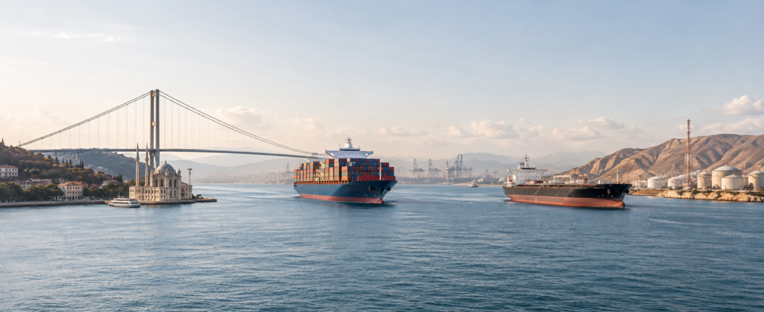
The Bosphorus runs through Istanbul. Former waterfront villages have become urban neighbourhoods, while palaces, fortresses, ferry piers, parks, marinas and housing line much of both banks. The southern entrance meets the Historic Peninsula, part of a UNESCO World Heritage property associated with more than two millennia of imperial, religious and architectural history.[7] The northern reaches retain larger areas of wooded shoreline.
Municipal ferries connect neighbourhoods across and along the Bosphorus, and separate services operate sightseeing routes.[8] Commuters, fishing boats, excursion vessels and international cargo ships use the same waterway. The shore is both a transport edge and a major public landscape.
Settlement around the Taiwan Strait is distributed among separate coastal regions. Fujian includes ports and cities such as Xiamen, Quanzhou and Fuzhou. Western Taiwan contains the port-industrial regions of Kaohsiung and Taichung as well as fishing towns, energy facilities and extensive urban development. The strait supports port employment, fishing and manufacturing supply chains, but regular passenger movement between the main shores is limited. Cross-strait ferry services are concentrated around the Taiwan-administered islands of Kinmen and Matsu.[9]
Hormuz has a smaller coastal population. Bandar Abbas is the principal Iranian port near the western approach, while Khasab is the main town on Musandam. Qeshm and Hormuz islands contain settlements supported by fishing, port activity, local trade and tourism. Large commercial vessels generally pass these communities rather than serving them directly.
Navigation and transport infrastructure
Official Turkish figures record 40,172 ship movements through the Bosphorus in 2025.[10] Vessel traffic services monitor the passage, and ships follow an IMO-recognised traffic-separation scheme. Two-way traffic is normal, although authorities may temporarily organise one-way movement when vessel size, weather or other safety conditions require it.[11]
Three road bridges cross the Bosphorus. The Marmaray immersed-tube railway and the Eurasia road tunnel provide two further fixed links below the water.[12][13] Ferries continue to serve journeys that the bridges, tunnels and connecting road or rail networks do not duplicate.
The main Taiwan Strait has no bridge or tunnel. Commercial vessels follow several routes between ports in the South China Sea, East China Sea and western Pacific rather than a single narrow track. AIS-based Taiwanese transport research identifies bulk carriers, container ships and tankers as the principal vessel categories in the waters surrounding Taiwan.[14]
Hormuz also has no fixed crossing. Under normal conditions, navigation is organised around the IMO traffic-separation scheme, supported by navigation systems, ports, anchorages and oil and gas terminals at the approaches.[15] Tankers and LNG carriers are especially prominent, but container ships and other cargo vessels also use the route to serve Gulf ports.
Economic role and alternatives
The Bosphorus provides the only maritime route from Black Sea ports to the Sea of Marmara and onward through the Dardanelles to the Mediterranean. Grain, petroleum products, metals, coal and other bulk cargoes pass through it. Pipelines and railways can divert selected commodities, but no alternative sea route exists for Black Sea shipping.
The Taiwan Strait carries a broader cargo mix. CSIS estimates that in 2024 approximately $1.3 trillion of China’s imports and exports passed through it. The corresponding estimates were about $413 billion for Japan and $300 billion for South Korea. Taiwan’s ports handled approximately $517 billion in trade, including trans-shipments.[16] Energy cargoes, raw materials, electronics, machinery and containerised goods all contribute to the route’s value.
Ships can avoid the Taiwan Strait by travelling east of Taiwan or through the Luzon Strait. The additional distance varies with origin, destination, port calls and the area affected by a crisis. Rerouting would increase time, fuel and insurance costs, while a wider conflict could also affect ports and alternative waters around Taiwan.
Hormuz carried about 20 million barrels per day of crude oil and petroleum products in 2025, equivalent to roughly one-quarter of global seaborne oil trade. More than 110 billion cubic metres of LNG also passed through it.[5] Saudi Arabia and the United Arab Emirates have pipelines terminating outside the Persian Gulf, but their available capacity can replace only part of normal strait traffic. Iran, Iraq, Kuwait, Qatar and Bahrain depend on Hormuz for most of their oil exports.[5][6]
Governance and maritime security
The Bosphorus lies within Türkiye and is governed by Turkish law and the 1936 Montreux Convention. Merchant vessels enjoy freedom of passage and navigation in peacetime, subject to safety and sanitary requirements and payment for services used. Warships face restrictions based on vessel type, tonnage, notification, length of stay and whether their flag state borders the Black Sea.[17]
China claims sovereignty over Taiwan, while Taiwan is governed by its own authorities. Both sides maintain territorial-sea and maritime legislation. The strait is wider than their combined 12-nautical-mile territorial seas, leaving central routes within overlapping claimed exclusive economic zones. Under UNCLOS, coastal states hold specified resource rights in an EEZ, while vessels and aircraft of other states retain freedoms of navigation and overflight. Article 36 preserves these EEZ freedoms where a route of similar convenience exists through a strait.[18]
Military activity remains frequent. Taiwan’s 2025 National Defense Report describes People’s Liberation Army air, naval and coast-guard operations around the island, including median-line crossings and exercises involving blockade and vessel-inspection scenarios.[19] Merchant shipping continues during ordinary periods, but exercises and confrontation can enlarge exclusion zones, delay voyages and raise insurance costs.
Iran and Oman are the coastal states at Hormuz. Navigation is governed by the law of the sea, coastal-state jurisdiction and IMO routeing measures. UNCLOS sets out transit passage through straits used for international navigation. The traffic-separation scheme proposed by Iran and Oman was adopted by IMO in 1968.[15] The U.S. Fifth Fleet and the multinational International Maritime Security Construct are headquartered in Bahrain; the construct was established in 2019.[20]
Since the war began on 28 February 2026, traffic through Hormuz has fallen sharply, and reported mines have made the established traffic-separation scheme unusable.[15] On 27 August, regional governments were discussing an Iran–Oman corridor, mine clearance and the restoration of safe passage after another tanker attack.[21]
Environmental conditions and hazards
In the Bosphorus, strong currents, abrupt turns, fog and interaction between local and international vessels create collision and grounding risks. A hazardous-cargo accident could affect densely occupied shores, ferry operations and historic waterfronts. Istanbul’s earthquake exposure adds a wider urban risk but is separate from the strait’s routine navigational conditions.
The Taiwan Strait is exposed to northeasterly winter monsoons and tropical cyclones. High winds, waves, storm surge and poor visibility can close ports or delay shipping.[4] Its shallow shelf supports fisheries alongside industrialised coasts. Fishing pressure, coastal construction, wastewater, port operations and ship emissions all affect the marine environment.
Hormuz carries exceptional volumes of hydrocarbons through an ecologically sensitive region. The surrounding sea contains coral reefs, seagrass, mangroves, marine turtles and dugongs, and coastal fisheries depend on these habitats.[22] Mines, damaged ships and restricted access during conflict increase both spill risk and the difficulty of emergency response.
Historical development and symbolism
The Bosphorus shaped the development of Byzantium, Constantinople and the Ottoman capital. Fortresses on opposing banks guarded the channel, while palaces and religious monuments defined the imperial waterfront.[7] Its modern bridges, tunnels and ferries place this history inside a functioning metropolitan transport network. The Europe–Asia boundary remains central to its public image.
The Taiwan Strait became a political boundary after the Chinese Civil War and the establishment of separate governments on the mainland and Taiwan in 1949. The armed crises of the 1950s and later confrontations gave the waterway a military identity. Commercial shipping and manufacturing links simultaneously bind the surrounding economies together.
Hormuz was a major trading centre centuries before the oil era. Portugal established control over Hormuz in 1515; Safavid forces, supported by the English East India Company, captured it in 1622.[23] Petroleum exports transformed the route’s economic scale in the 20th century. The Iran–Iraq Tanker War, later ship seizures and the 2026 conflict reinforced its association with disruptions to global energy supply.[21][24]
Comparative conclusion
The Bosphorus presents the most demanding ship-handling environment because a short, winding international passage shares space with dense metropolitan movement. The Taiwan Strait offers more navigational room and alternative routes, while military activity can threaten several ports and sea lanes at once. Hormuz has wider navigable water than the Bosphorus, yet its traffic scheme concentrates a large share of global oil and LNG exports within range of coastal military forces.