Snapshot
| Playa Norte | Hat Tham Phra Nang | Whitehaven Beach | |
|---|---|---|---|
| Setting | Town beach on Isla Mujeres, beside hotels, restaurants and ferry-linked streets | Small Railay beach enclosed by limestone, reached by boat and on foot | Seven-kilometre beach on an uninhabited national-park island |
| Sand and water | Soft pale sand; very shallow, usually calm turquoise water | Pale sand; clear water in settled weather; cliffs and caves at the shoreline | White quartz-rich silica sand; shallow turquoise water and tidal sand patterns |
| Best for | Easy swimming and a serviced full beach day | Cliffs, caves, swimming and wider Railay activities | A long undeveloped shore and a boat-based national-park visit |
| Main limitation | Commercial occupation and little seclusion | Crowding and shrinking dry sand at high tide | Boat dependence and limited shore facilities |
| Access | Passenger ferry to Isla Mujeres, then town access | Long-tail boat to Railay, followed by a walk | Private or commercial boat only |
| Facilities | Extensive, mainly through beach clubs and nearby businesses | Limited on the beach; more choice elsewhere in Railay | Basic park facilities; tour vessels may add food, toilets or shade |
| Physical accessibility | A ramp and amphibious beach chair were documented in 2023; current provision should be checked | Boat transfers, walking and loose sand create barriers; no current audited route was found | Queensland Parks states that the national park has no wheelchair-accessible facilities |
Location & coastal setting
Playa Norte occupies the northern end of Isla Mujeres, beside the island’s main settlement and ferry district. Hotels, restaurants, streets and beach businesses sit directly behind or close to the sand. Its northern and western exposure also makes it more sheltered than the island’s Caribbean-facing east coast. [1][2]
Phra Nang lies at the southern end of the Railay peninsula on the Krabi mainland. Limestone headlands enclose the coast and separate Railay from the developed shore around Ao Nang. [7][8]
Whitehaven lies on the southeast coast of Whitsunday Island, about 25 kilometres east of Airlie Beach. It has no settlement, road or resort strip. [13]
Sand & shoreline character
Playa Norte has soft, pale sand beside very shallow water. Tourism and visitor sources consistently describe it as white or near-white, but no recent beach-specific study was found that establishes its grain size or mineral composition. [1]
Phra Nang also has pale, soft sand. Cliff bases, caves and limestone outcrops break up the shore, so it does not read as one long, uninterrupted strip. The available descriptions are based on observation rather than a recent sediment survey. [9][10]
Whitehaven is the only one of the three with well-documented quartz-rich silica sand. Queensland Parks says the material did not originate from the island’s local rock and accumulated through coastal transport. The often-repeated figure of “98.9% silica” was not substantiated in the government material reviewed. [13][15]
Beach morphology & usable space
Playa Norte has a gentle slope and a broad bathing zone. The dry beach is large enough to support heavy use, but loungers, restaurant seating and beach clubs occupy substantial sections. The result is comfortable rather than spacious or visually empty. [1][4]
Phra Nang is the most constrained. High tide can cover much of the sand at the right-hand end, while visitors arriving by boat and walking from Railay gather around the cave and the central swimming area. Conditions vary by tide and time of day, but the beach has little spare space when both work against it. [9][10]
Whitehaven extends for seven kilometres. Tour groups cluster around recognised landing points, Hill Inlet and southern day-use areas, but the full shoreline offers far more room than either Playa Norte or Phra Nang. Published park data do not provide current visitor counts by beach sector. [13]
Water clarity & appearance
Playa Norte is known for transparent, turquoise water over a pale, shallow seabed. Its colour and clarity are visually consistent enough to define the beach, although these descriptions are not the same as continuous water-quality measurements. [1][5]
Phra Nang can be clear and green-blue in settled weather. Rain, wind and Andaman-season conditions make its appearance less predictable than promotional photographs suggest. No current beach-specific turbidity or bacteriological series was found. [9][10]
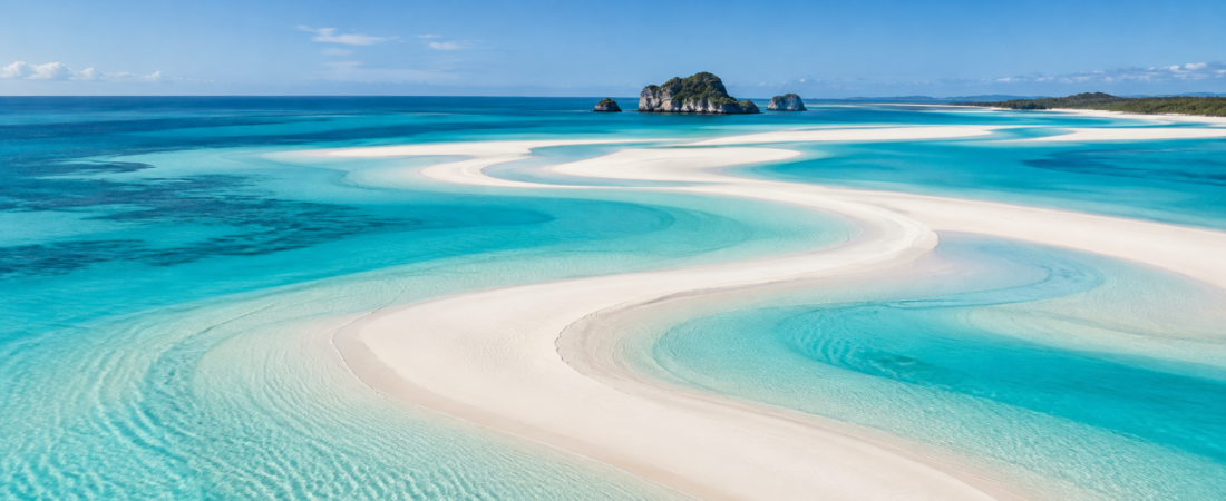
At Whitehaven, white silica sand and shallow water produce a sharp white-and-turquoise contrast. Hill Inlet adds changing bands of sand and water as the tide moves. Wind, rain and suspended sediment can still alter visibility, so none of the three can be declared permanently clearer than the others. [13][15]
Swimming & sea conditions
Playa Norte is the easiest swimming beach of the three. The entry is gradual, the water remains shallow far from shore and wave action is usually low. It suits wading, floating, children and swimmers who dislike surf. Reliable current confirmation of lifeguard coverage across the whole beach was not found. [1]
Phra Nang is widely used for swimming and can be calm when the weather is settled. Tide and monsoon conditions matter more here, and observations from one visit cannot establish the behaviour of currents throughout the year. It is a good swimming beach in suitable weather, but not a permanently placid lagoon. [9][10]
Whitehaven is also used for swimming. Queensland Parks warns that tides and water movement around the Whitsunday islands can change quickly, so swimmers need to assess conditions rather than assume that pale, shallow-looking water is calm. [14]
Landscape character & visual distinctiveness
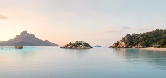
Playa Norte is a low, open landscape. Pale sand meets a broad field of shallow Caribbean water, with palms, loungers, hotels, boats and people forming part of the view. Its identity comes from water colour and bathing conditions rather than dramatic relief. [1][4]
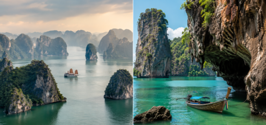
Phra Nang compresses much more vertical scenery into a short shore. Limestone rises directly behind the sand, caves open at beach level and offshore karst formations interrupt the horizon. The Princess Cave shrine adds a living cultural feature to the geology; it remains a sacred place where fishermen leave offerings. [9]
Whitehaven is defined by length, an undeveloped vegetated edge and the contrast between quartz-rich sand and reef-island water. At the northern end, Hill Inlet creates tidal patterns on a scale absent from the other two beaches. [13][15]
Access to the beach
Playa Norte requires a ferry crossing from Cancún, but it is straightforward once the visitor reaches Isla Mujeres. Ultramar runs regular services between Puerto Juárez and the island, and the beach is within the main town rather than at the end of a second excursion. [2]
Phra Nang has no road access. From Ao Nang, the usual route is a long-tail boat to Railay followed by a walk through the peninsula. Visitors already staying in Railay avoid the daily boat crossing but still reach the beach on foot. [7][9][12]
Whitehaven can be reached only by private or commercial boat. Most visitors arrive on organised trips from Airlie Beach, Hamilton Island or another Whitsunday base. [13]
Physical accessibility
A 2023 accessibility report documented a concrete ramp near Playa Norte and an amphibious beach wheelchair. This is the most specific adaptive-access evidence found for any of the three beaches, but it is now three years old. Anyone relying on the equipment should confirm that it is still available and staffed. [3]
No current wheelchair route, adaptive bathing programme or formal access audit was found for Phra Nang. Transfers from a long-tail boat, the pedestrian route through Railay and loose sand can all present barriers. Resorts or private operators may be able to arrange assistance, but that does not create an independently accessible route. [7][9]
Queensland Parks states that Whitsunday Islands National Park has no wheelchair-accessible facilities. Boat operators may assist individual passengers, but Whitehaven itself should not be treated as an accessible public beach. [14]
Facilities & comfort
Playa Norte has the widest range of food, drink, loungers, umbrellas and water-sports rentals. Toilets and showers are often tied to beach clubs or restaurants rather than provided as a clearly documented free public network. A comfortable day is easy to arrange if the visitor is willing to use commercial facilities. [1][4]
Phra Nang has far less dependable provision on the sand. Reports disagree over whether food boats operate regularly, and no authoritative 2026 inventory resolves the question. Railay has restaurants, resorts and shops, but visitors should not expect Playa Norte-style service directly on Phra Nang Beach. [9][24]
Whitehaven provides picnic tables, some shelter, basic toilets and a small designated campground. There is no supplied drinking water, campers must remove their rubbish, and fires and generators are prohibited. Day-tour vessels may provide meals, toilets, shade or equipment, but those services leave with the boat. [13][14]
Activities & water use
Playa Norte supports swimming, floating, paddleboarding and kayaking without requiring visitors to leave the developed beach area. Equipment is widely available through local businesses. Snorkelling over the main sandy bathing zone is less rewarding than reef trips elsewhere around Isla Mujeres. [4][22]
At Phra Nang, swimmers share the waterline with long-tail boats. Kayaking is available around Railay, while the peninsula’s limestone makes climbing and short hikes important parts of a visit, even when those activities take place away from the bathing area. [7][8]
Queensland Parks lists walking, snorkelling, diving, canoeing, kayaking and boating at Whitehaven. Camping is possible with a permit. Visitors normally bring equipment themselves or receive it through a tour operator. [13]
Crowding, noise & atmosphere
Playa Norte is social and commercial rather than quiet. Ferry access, hotels, beach clubs, vendors and restaurants bring a steady flow of people, music and service activity. Its atmosphere changes by sector and time of day, and no reliable current attendance count supports a claim that it is always full. [1][5]
Phra Nang has a sharper day-trip cycle. A January 2025 review described crowding around the cave, while a 2020 account reported dozens of boats and hundreds of visitors by mid-morning. The older report cannot serve as a current count, but it shows how quickly a small beach can fill when boat arrivals overlap. [9]
Whitehaven also receives heavy tour traffic, but it spreads unevenly across a much longer shore. Hill Inlet, Tongue Bay and established day-use areas can be busy at scheduled arrival times. Away from those points, there is no road, resort or nightlife to create a constant background of urban sound. [13]
Safety & natural hazards
Playa Norte’s shallow water and low wave energy make ordinary bathing relatively easy. Remaining concerns include heat, boat traffic, changing weather and the lack of confirmed beach-wide lifeguard coverage. [1]
At Phra Nang, sea conditions and boat movements deserve more attention than the gentle appearance of the beach might suggest. Thailand issued national jellyfish guidance in 2025, including advice concerning box jellyfish, but that warning does not establish a persistent Phra Nang problem. No reliable current source confirmed comprehensive lifeguard coverage. [9][11]
Whitehaven has the clearest official warnings and the least immediate support. There are no lifeguards, and medical help may take hours. Queensland Parks advises visitors to plan for marine stingers, sharks, crocodiles, heat and limited communications, and recommends protective stinger clothing. These are regional precautions rather than evidence of frequent dangerous encounters on Whitehaven itself. [14]
Ecology & environmental protection
Playa Norte belongs to a heavily visited island with sensitive reef habitat nearby. Reporting based on Mexican conservation information identifies La Cadenita reef as habitat for threatened Acropora corals. The available material did not establish that every part of the beach lies within the same protected boundary, so the beach and nearby reef waters should not be treated as legally identical. [5]
Phra Nang is associated with the protected Railay–Krabi marine landscape and Hat Noppharat Thara–Mu Ko Phi Phi National Park. A current primary map confirming the exact status of the beach parcel was not found. The clearer local pressure is visitor concentration around boats, paths, cliffs and caves. [7][8][9]
Whitehaven has the clearest formal protection. It lies inside Whitsunday Islands National Park and within the UNESCO-listed Great Barrier Reef World Heritage Area. Surrounding waters are managed through Great Barrier Reef marine zoning. Camping limits, waste rules and bans on fires and generators keep permanent development off the shore. [13][16][27]
Seasonality & weather reliability
Playa Norte remains warm enough for beach use throughout the year, but the wetter, storm-prone season can disrupt ferries and water conditions. Sargassum adds another variable, particularly during an exceptional regional year such as 2026. Isla Mujeres’ northern and western shores are often less affected than exposed mainland beaches, but no week can be guaranteed seaweed-free. [6][25]
At Phra Nang, the dry season offers the best chance of calm water and comfortable small-boat travel. Rain, wind and Andaman monsoon conditions outside that period can reduce water clarity and make long-tail transfers less pleasant or less reliable. Late December and early January are also peak visitor periods in Krabi. [7][8]
Whitehaven’s wetter period generally runs from January through March, while spring is often sunnier and less humid. Boat access makes weather disruption more consequential than at a road-access beach. [17]
LGBT+ openness & comfort
None of the three is documented as a specifically LGBT+ beach, and no recent beach-level survey allows a confident ranking of personal comfort or harassment risk.
Playa Norte sits within Mexico’s framework of marriage equality and federal protection relating to sexual preference. Isla Mujeres receives a broad international tourism market, but national law and a mixed visitor profile do not prove that every LGBT+ visitor has the same experience. [18][19]
Thailand’s marriage-equality law took effect on January 23, 2025. Railay-specific evidence remains sparse, and legal gaps still affect trans people, including the absence of full legal gender recognition. Respectful behaviour at the Princess Cave shrine is expected from every visitor and is not an LGBT+-specific restriction. [9][20]
Whitehaven falls under Australian and Queensland law. Queensland’s anti-discrimination framework expressly covers sexuality and gender identity. The beach itself is a national-park excursion site rather than a social or nightlife setting. [21]
Complementary experiences nearby
Playa Norte is easiest to combine with ordinary town life. Visitors can move directly between the beach, restaurants, accommodation and Isla Mujeres streets. Farther afield are Punta Sur, Garrafón, the MUSA underwater museum area, reef diving, Isla Contoy trips and seasonal whale-shark excursions. [22][23]
Phra Nang belongs to a compact Railay landscape that includes Railay West, Railay East, caves and the viewpoint and lagoon route. Boat trips commonly connect the peninsula with Ko Poda, Thale Waek and other stops in the “Four Islands” circuit. [7][8][26]
Whitehaven’s nearby experiences remain tied to the protected island and surrounding sea. Hill Inlet and its lookout are the principal addition at the northern end, while the Ngaro Sea Trail and other Great Barrier Reef trips extend the visit. Most organised activities begin from Airlie Beach, Hamilton Island or a vessel rather than from Whitehaven itself. [13][16]
Final assessment
Playa Norte is the most practical all-day beach. It has the easiest swimming, the fullest range of food and comfort, and the simplest independent access after the ferry to Isla Mujeres. Those advantages come with beach clubs, loungers, vendors and steady social noise. Choose it when swimming and convenience matter more than seclusion.
Phra Nang is the most concentrated landscape experience. Limestone, caves, the shrine, swimming, boats and Railay’s wider climbing and walking routes all meet within a small area. The same compression makes the beach vulnerable to high tide and excursion crowds. Choose it for scenery and an active Railay day, not for dependable solitude or resort-level service on the sand.
Whitehaven is the longest and least developed. Its silica shore, national-park setting and distance from permanent settlement give it a scale and visual continuity that the other two cannot match. Access, safety and comfort depend heavily on boats and preparation. Choose it for an undeveloped island coast and accept that the experience is less spontaneous and less supported.
Sources and endnotes
1. Mexican Caribbean, “Las mejores playas de Isla Mujeres,” September 29, 2024. Regional destination authority; used for Playa Norte’s shallow water, low wave action, pale sand and beachfront food and drink.
2. Ultramar, Isla Mujeres schedules, fares and terminal information, accessed September 2026. Used for the Puerto Juárez–Isla Mujeres ferry and terminal information.
3. A Piece of Travel, Isla Mujeres wheelchair-accessibility report, March 2023. Used for the documented ramp and amphibious beach chair at Playa Norte.
4. Cestee, Playa Norte guide, accessed September 2026. Used for loungers, umbrellas, commercial toilets and showers, and water-sports facilities.
5. El País México, February 20, 2025, reporting on Playa Norte, Isla Mujeres and La Cadenita reef. Used for recent beach description and nearby Acropora habitat.
6. Reuters, August 2026, reporting on the exceptional Mexican Caribbean sargassum season. Used for the regional scale of removals and the expected annual record.
7. Tourism Authority of Thailand, Krabi destination material, accessed September 2026. Used for Railay and Phra Nang geography, Ao Nang boat access and broad visitor seasonality.
8. Tourism Authority of Thailand, “10 Things to Do in Krabi,” January 9, 2020. Used for stable Railay geography, climbing and wider activity context.
9. Tripadvisor, Phra Nang Cave Beach visitor reviews from 2020–2025. Used selectively for the walking route, shrine, crowding and changes in food provision.
10. The Manduls, Phra Nang Beach guide, accessed September 2026. Used for observed swimming conditions and loss of dry sand at high tide.
11. Tourism Authority of Thailand News, jellyfish-safety guidance, August 2025. Used for national advice on dangerous jellyfish and monsoonal conditions.
12. ThailandMagazine, Phra Nang and Railay visitor guide, accessed September 2026. Consulted for boat access, walking connections and beach form.
13. Queensland Government, Department of the Environment, Tourism, Science and Innovation, “Whitehaven Beach, Whitsunday Island,” accessed September 2026. Used for beach length, boat access, camping, toilets, picnic facilities, activities, drinking-water provision and national-park rules.
14. Queensland Government, “Visiting safely—Whitsunday Islands National Park,” accessed September 2026. Used for accessibility, lifeguards, remoteness, emergency response, communications and official hazard advice.
15. Queensland Parks and Forests, Whitsunday Islands nature and culture information, accessed September 2026. Used for the origin and movement of Whitehaven’s quartz-rich sand.
16. Great Barrier Reef Marine Park Authority, Whitsundays zoning information, accessed September 2026. Used for the surrounding marine-protection framework.
17. Tourism Australia, Whitsundays climate guidance, accessed September 2026. Used for broad seasonal rainfall, humidity and sunshine patterns.
18. ILGA World, global LGBTI rights maps, updated May 10, 2026. Used for national legal context.
19. ILGA World Database, legal protections concerning violence and discrimination, updated June 2026. Used for Mexico’s federal legal context.
20. Reuters, January 23, 2025, reporting on Thailand’s marriage-equality law and continuing gaps in legal gender recognition.
21. Queensland Human Rights Commission, protected attributes under Queensland anti-discrimination law, accessed September 2026.
22. Mexican Caribbean destination material on Isla Mujeres activities, accessed September 2026. Used for snorkelling, kayaking, paddleboarding and marine attractions.
23. Mexican Caribbean destination material on Punta Sur and Isla Contoy, accessed September 2026. Used for complementary experiences around Isla Mujeres.
24. AwayGoWe, Railay guide, accessed September 2026. Used to document recent references to “Phra Nang Boat Eats” and wider Railay activities.
25. TravelPirates and A Taste for Travel, 2025–2026 Mexican Caribbean sargassum guidance. Used cautiously for the tendency of north- and west-facing Isla Mujeres beaches to receive less sargassum than exposed mainland shores.
26. Tourism Authority of Thailand, Krabi island-route material, accessed September 2026. Used for connections between Railay, Ko Poda, Thale Waek and common Krabi boat routes.
27. UNESCO World Heritage Centre, “Great Barrier Reef,” World Heritage List entry 154, accessed September 2026. Used for the Great Barrier Reef’s 1981 inscription and the inclusion of the Whitsunday Islands within the listed property.